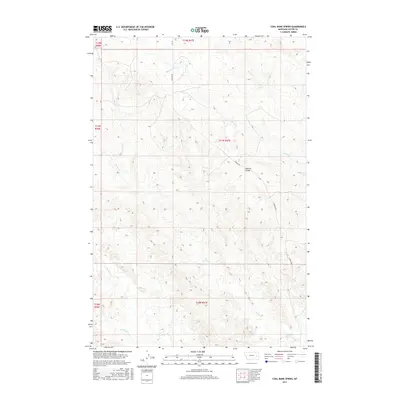
2017 Map of Coal Bank Spring
USGS Topo · Published 2017About this map
Coal Bank Spring marks a vital water point in this stretch of eastern Montana, where the drainage patterns of Muster Cr and Harris Cr define the landscape. This 2017 survey by the U.S. Geological Survey illustrates the varied terrain of Custer County, characterized by features like Caprock Coulee and the winding paths of Sand Cr and its W Fork Sand Cr. The map reveals a land structured by section lines and the singular path of Caprock Rd, serving as a modern record of a sparsely populated ranching region. The distribution of these named coulees and creeks provides essential context for understanding the hydrology and land use in this part of the northern Great Plains.
Find a feature on this map
13 named features on this map. Tap any name to fly to it.
Don’t see what you’re looking for? This feature index may not catch every label — zoom into the map to look around manually.
Map Details
Editions of this 2017 Coal Bank Spring Map
This is the sole edition of this map. No revisions or reprints were ever made.
Other maps of this area

1953 · Miles City
USGS Topo · 1:250,000

1957 · Miles City
USGS Topo · 1:250,000

1958 · Miles City
USGS Topo · 1:250,000

1965 · Twin Buttes School
USGS Topo · 1:24,000

1965 · Morehouse Creek
USGS Topo · 1:24,000

1969 · Horse Creek Hill
USGS Topo · 1:24,000

1969 · Noble Reservoir
USGS Topo · 1:24,000
1969 · Deadman Creek
USGS Topo · 1:24,000
1969 · Coal Bank Spring
USGS Topo · 1:24,000

1969 · Kinsey
USGS Topo · 1:24,000