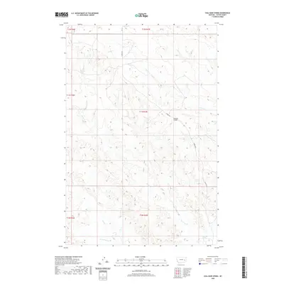
2020 Map of Coal Bank Spring
USGS Topo · Published 2020About this map
Coal Bank Spring serves as a primary landmark in this section of Custer County, situated near the southeastern edge of the quadrangle. The landscape is defined by the drainage systems of Harris Cr and Muster Cr, which carve through the terrain to create a network of draws and ridges. These seasonal watercourses dictate the historical movement and land use throughout the townships. Caprock Coulee provides a distinct break in the elevation, while Caprock Rd offers the main transit corridor through the area. Further west, Sand Cr and its tributary, W Fork Sand Cr, delineate the western boundaries of the survey. This map effectively illustrates the sparse, ranching-oriented settlement pattern characteristic of eastern Montana, where life and geography revolve around localized water sources and established access roads across the high plains.
Find a feature on this map
13 named features on this map. Tap any name to fly to it.
Don’t see what you’re looking for? This feature index may not catch every label — zoom into the map to look around manually.
Map Details
Editions of this 2020 Coal Bank Spring Map
This is the sole edition of this map. No revisions or reprints were ever made.
Other maps of this area

1953 · Miles City
USGS Topo · 1:250,000

1957 · Miles City
USGS Topo · 1:250,000

1958 · Miles City
USGS Topo · 1:250,000

1965 · Twin Buttes School
USGS Topo · 1:24,000

1965 · Morehouse Creek
USGS Topo · 1:24,000

1969 · Horse Creek Hill
USGS Topo · 1:24,000

1969 · Noble Reservoir
USGS Topo · 1:24,000
1969 · Deadman Creek
USGS Topo · 1:24,000
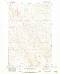
1969 · Coal Bank Spring
USGS Topo · 1:24,000

1969 · Kinsey
USGS Topo · 1:24,000