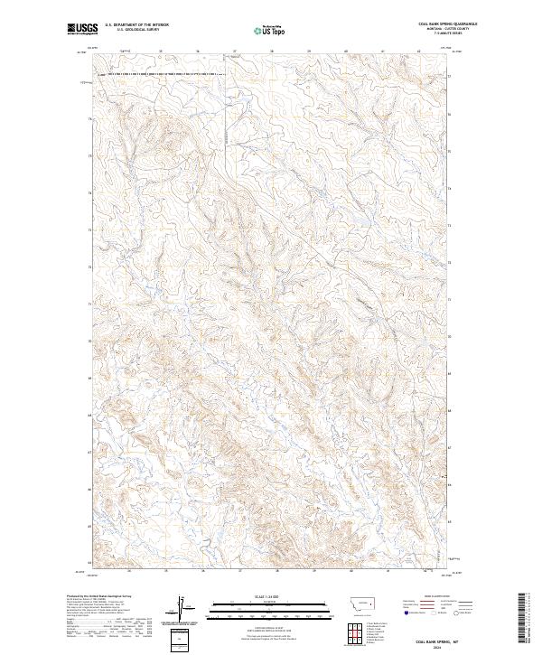
2024 Map of Coal Bank Spring
USGS Topo · Published 2024About this map
Coal Bank Spring serves as a critical watering point in this remote section of Custer County, where the high plains are deeply dissected by seasonal drainages. The landscape is defined by the winding paths of Harris Creek, Muster Creek, and Sand Creek, which carve through the local topography to create a complex network of ridges and draws. These waterways dictate the movement across the terrain, as seen in the alignment of ranch roads like Caprock Rd and Reed Rd. Evidence of the area's geological character is found at Caprock Coulee, where the harder surface layers protect the softer sediments below from erosion. This 2024 survey documents the enduring ranching infrastructure of eastern Montana, where life still revolves around established water sources like the West Fork Sand Creek and the township and range lines that have organized this territory since the early days of settlement.
Find a feature on this map
14 named features on this map. Tap any name to fly to it.
Don’t see what you’re looking for? This feature index may not catch every label — zoom into the map to look around manually.
Map Details
Editions of this 2024 Coal Bank Spring Map
This is the sole edition of this map. No revisions or reprints were ever made.
Other maps of this area

1953 · Miles City
USGS Topo · 1:250,000

1957 · Miles City
USGS Topo · 1:250,000

1958 · Miles City
USGS Topo · 1:250,000

1965 · Twin Buttes School
USGS Topo · 1:24,000

1965 · Morehouse Creek
USGS Topo · 1:24,000

1969 · Horse Creek Hill
USGS Topo · 1:24,000

1969 · Noble Reservoir
USGS Topo · 1:24,000
1969 · Deadman Creek
USGS Topo · 1:24,000
1969 · Coal Bank Spring
USGS Topo · 1:24,000

1969 · Kinsey
USGS Topo · 1:24,000