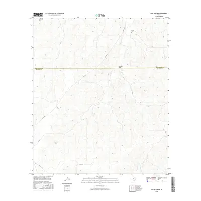
2016 Map of Coal Kiln Draw
USGS Topo · Published 2016About this map
Coal Kiln Draw and Berrenda Draw carve through this high plateau region of the Edwards Plateau during the mid-2010s. The landscape is defined by its drainage network, including the headwaters of W Copperas Cr and the winding path of Epps Cr. A notable point of local historical interest is the Morales Cem located in the northern portion of the quadrangle. The map captures the boundary between Schleicher County and Sutton County, illustrating how modern infrastructure like Ranch Rd 864 and Ryan Rd follows the natural contours of the draws. This survey provides a clear view of the rural ranching infrastructure and private road systems that serve these remote West Texas uplands.
Find a feature on this map
15 named features on this map. Tap any name to fly to it.
Don’t see what you’re looking for? This feature index may not catch every label — zoom into the map to look around manually.
Map Details
Editions of this 2016 Coal Kiln Draw Map
This is the sole edition of this map. No revisions or reprints were ever made.
Other maps of this area

1893 · Fort McKavett
USGS Topo · 1:125,000

1954 · Sonora
USGS Topo · 1:250,000

1958 · Sonora
USGS Topo · 1:250,000

1963 · Buffalo Well
USGS Topo · 1:24,000

1963 · McKegan Draw
USGS Topo · 1:24,000

1963 · Buffalo Well SE
USGS Topo · 1:24,000

1963 · Adams SE
USGS Topo · 1:24,000
1963 · Brokeleg Mountain
USGS Topo · 1:24,000
1963 · Coal Kiln Draw
USGS Topo · 1:24,000

1963 · McKegan Draw NE
USGS Topo · 1:24,000