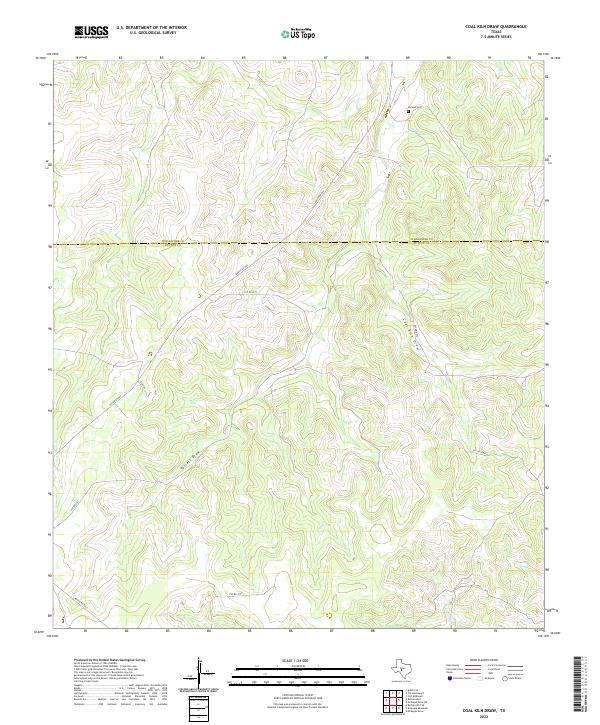
2022 Map of Coal Kiln Draw
USGS Topo · Published 2022About this map
Morales Cem sits in the northern reaches of this landscape, a small ancestral marker in a region defined by its ephemeral drainage systems. The terrain is deeply inscribed by seasonal waterways like Coal Kiln Draw and Terrett Draw, which carve through the Edwards Plateau and carry runoff toward larger tributaries. These dry draws and creeks, including Epps Cr and W Copperas Cr, dictate the layout of local travel and property boundaries in this ranching country.
Find a feature on this map
15 named features on this map. Tap any name to fly to it.
Don’t see what you’re looking for? This feature index may not catch every label — zoom into the map to look around manually.
Map Details
Editions of this 2022 Coal Kiln Draw Map
This is the sole edition of this map. No revisions or reprints were ever made.
Other maps of this area

1893 · Fort McKavett
USGS Topo · 1:125,000

1954 · Sonora
USGS Topo · 1:250,000

1958 · Sonora
USGS Topo · 1:250,000

1963 · Buffalo Well
USGS Topo · 1:24,000

1963 · McKegan Draw
USGS Topo · 1:24,000

1963 · Buffalo Well SE
USGS Topo · 1:24,000

1963 · Adams SE
USGS Topo · 1:24,000
1963 · Brokeleg Mountain
USGS Topo · 1:24,000
1963 · Coal Kiln Draw
USGS Topo · 1:24,000

1963 · McKegan Draw NE
USGS Topo · 1:24,000