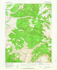
1954 Map of Coates Creek
USGS Topo · Published 1963About this map
The Colorado River and Dolores River carve through high desert plateaus along the Utah-Colorado border, creating a landscape of massive sandstone formations and deep canyons. This mid-century survey, produced in cooperation with the Atomic Energy Commission, reflects an era of intense resource exploration in the Colorado Plateau. High plateaus like Sevenmile Mesa, Steamboat Mesa, and Blue Chief Mesa dominate the topography, punctuated by isolated landmarks such as Big Triangle and Little Triangle.
Find a feature on this map
52 named features on this map. Tap any name to fly to it.
Don’t see what you’re looking for? This feature index may not catch every label — zoom into the map to look around manually.
Map Details
Editions of this 1954 Coates Creek Map
3 editions found

Other maps of this area

1885 · East Tavaputs
USGS Topo · 1:250,000

1885 · La Sal
USGS Topo · 1:250,000

1949 · Gateway
USGS Topo · 1:24,000

1952 · Gateway
USGS Topo · 1:24,000

1954 · Westwater 4 SW
USGS Topo · 1:24,000

1954 · Mt. Waas 4 NE
USGS Topo · 1:24,000

1954 · Mt. Waas 4 NW
USGS Topo · 1:24,000

1954 · Mt. Waas 3 NE
USGS Topo · 1:24,000

1954 · Mt. Waas 1 SW
USGS Topo · 1:24,000

1954 · Mt. Waas 1 NE
USGS Topo · 1:24,000