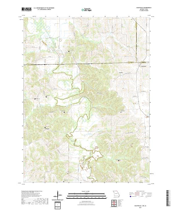
2021 Map of Coatsville
USGS Topo · Published 2021About this map
The Chariton River meanders through the heart of this landscape, marking the borderlands where Missouri meets Iowa. This contemporary survey of the Schuyler County region highlights a rural agricultural pattern defined by dispersed settlements like Coatsville and Guinn. For genealogists, the map is an exceptionally dense resource, locating numerous family-named burial grounds such as Kerby Cem, Hilltown Cem, and Hargrave Cem that dot the ridges above the river valley. The southern portion of the quadrangle is anchored by the Prairie Recreation Lake, while the road network follows established section lines and historic paths like Raven Town Rd and Gospel Ridge Rd. The proximity of settlements to the river and the variety of named cemeteries suggest a long-standing community tied to the local geography of northern Missouri.
Find a feature on this map
50 named features on this map. Tap any name to fly to it.
Don’t see what you’re looking for? This feature index may not catch every label — zoom into the map to look around manually.
Map Details
Editions of this 2021 Coatsville Map
This is the sole edition of this map. No revisions or reprints were ever made.
Other maps of this area

1911 · Queen City
USGS Topo · 1:62,500

1912 · Green City
USGS Topo · 1:62,500

1913 · Queen City
USGS Topo · 1:62,500

1914 · Green City
USGS Topo · 1:62,500

1939 · Centerville
USGS Topo · 1:62,500

1941 · Centerville
USGS Topo · 1:62,500

1954 · Centerville
USGS Topo · 1:250,000

1957 · Centerville
USGS Topo · 1:250,000

1958 · Centerville
USGS Topo · 1:250,000
1974 · Green City NE
USGS Topo · 1:24,000