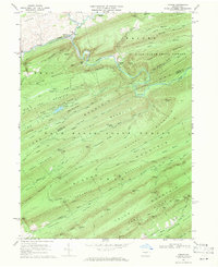
1968 Map of Coburn
USGS Topo · Published 1971About this map
Penns Creek and Elk Creek converge at the village of Coburn, forming a focal point for settlement and transportation within the gap between Second Mountain and Paddy Mountain. The Penn Central railroad line follows the narrow river corridor, passing the small station at Ingleby and cutting through the ridge at Tunnel Mtn. This late-1960s landscape is defined by the massive ridges of the Bald Eagle State Forest, where early industrial logging is evidenced by labels like Loggers Trail and Sawmill Knob.
Find a feature on this map
79 named features on this map. Tap any name to fly to it.
Don’t see what you’re looking for? This feature index may not catch every label — zoom into the map to look around manually.
Map Details
Editions of this 1968 Coburn Map
3 editions found
Other maps of this area

1924 · Centre Hall
USGS Topo · 1:62,500

1924 · Lewistown
USGS Topo · 1:62,500

1925 · Mifflintown
USGS Topo · 1:48,000

1927 · Lewisburg
USGS Topo · 1:62,500

1929 · Centre Hall
USGS Topo · 1:62,500

1934 · Mifflintown
USGS Topo · 1:62,500

1937 · Mifflintown
USGS Topo · 1:62,500

1937 · Millheim
USGS Topo · 1:48,000

1941 · Millheim
USGS Topo · 1:62,500

1943 · Lewistown
USGS Topo · 1:125,000
Featured Places
- Decatur Township, PA
- Penn View, Penn Township
- Penn Township, PA
- Ingleby, Haines Township
- Coburn, Penn Township