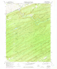
1968 Map of Coburn
USGS Topo · Published 1975About this map
The confluence of Elk Creek and Penn Creek anchors the village of Coburn, a focal point of this late 1960s study of the Centre and Mifflin County border. The landscape is defined by the high, parallel ridges of the Bald Eagle State Forest, where early transportation routes like the Penn Central rail line and the historic Kerstetter Path navigated the narrow gaps between Big Poe Mountain and Strong Mountain. Local life is marked by the presence of St Johns Ch and Trinity Ch in the north, while the southern reaches descend toward Salem Cem in the Lancaster Valley Creek area. A significant portion of the map is dedicated to the recreational development of Poe Valley State Park, which occupies a sheltered basin between ridges, providing a contrast to the isolated mountain settlements of Ingleby and Weikert.
Find a feature on this map
82 named features on this map. Tap any name to fly to it.
Don’t see what you’re looking for? This feature index may not catch every label — zoom into the map to look around manually.
Map Details
Editions of this 1968 Coburn Map
3 editions found
Other maps of this area

1924 · Centre Hall
USGS Topo · 1:62,500

1924 · Lewistown
USGS Topo · 1:62,500

1925 · Mifflintown
USGS Topo · 1:48,000

1927 · Lewisburg
USGS Topo · 1:62,500

1929 · Centre Hall
USGS Topo · 1:62,500

1934 · Mifflintown
USGS Topo · 1:62,500

1937 · Mifflintown
USGS Topo · 1:62,500

1937 · Millheim
USGS Topo · 1:48,000

1941 · Millheim
USGS Topo · 1:62,500

1943 · Lewistown
USGS Topo · 1:125,000