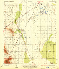
1943 Map of Cochise
USGS Topo · Published 1943About this map
Sulphur Spring Valley dominates this early 1940s landscape, centered on the stark expanse of the Willcox Playa and the railroad hub of Willcox. The presence of a sewage disposal plant and a landing field equipped with a radio range beacon reflects the infrastructure of the era, while the Southern Pacific railroad remains the primary artery for transit and commerce. Toward the west, the topography rises sharply into the Red Bird Hills and the northern reaches of the Coronado National Forest, where the Red Bird Mine and Golden Rule Mine indicate the region's mineral interests.
Find a feature on this map
33 named features on this map. Tap any name to fly to it.
Don’t see what you’re looking for? This feature index may not catch every label — zoom into the map to look around manually.
Map Details
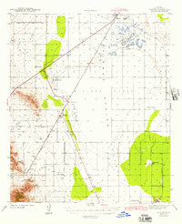
Editions of this 1943 Cochise Map
3 editions found
Other maps of this area

1915 · Benson
USGS Topo · 1:125,000

1916 · Pearce
USGS Topo · 1:125,000

1922 · Willcox
USGS Topo · 1:125,000

1922 · St. David
USGS Topo · 1:62,500

1926 · Light
USGS Topo · 1:62,500

1926 · Courtland
USGS Topo · 1:62,500

1943 · Dos Cabezas
USGS Topo · 1:62,500

1943 · Willcox
USGS Topo · 1:62,500

1943 · Benson
USGS Topo · 1:125,000

1943 · Cochise
USGS Topo · 1:62,500