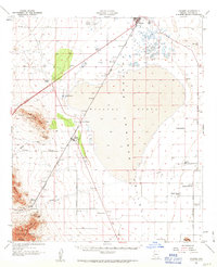
1958 Map of Cochise
USGS Topo · Published 1963About this map
Willcox Playa dominates this portion of the Sulphur Springs Valley, a vast dry lake bed that dictates the local geography and transportation routes. In this late 1950s record, the Southern Pacific railroad skirts the western edge of the playa, connecting the town of Willcox with the junction at Cochise. To the south and east, the Kansas Settlement Road serves the agricultural hub of Kansas Settlement, where a Cotton Gin and the Sulphur Spring School mark the center of local rural life.
Find a feature on this map
36 named features on this map. Tap any name to fly to it.
Don’t see what you’re looking for? This feature index may not catch every label — zoom into the map to look around manually.
Map Details
Editions of this 1958 Cochise Map
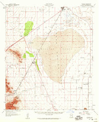
2 editions found
Other maps of this area

1915 · Benson
USGS Topo · 1:125,000

1916 · Pearce
USGS Topo · 1:125,000

1922 · Willcox
USGS Topo · 1:125,000

1922 · St. David
USGS Topo · 1:62,500

1926 · Light
USGS Topo · 1:62,500

1926 · Courtland
USGS Topo · 1:62,500

1943 · Dos Cabezas
USGS Topo · 1:62,500

1943 · Willcox
USGS Topo · 1:62,500

1943 · Benson
USGS Topo · 1:125,000

1943 · Cochise
USGS Topo · 1:62,500