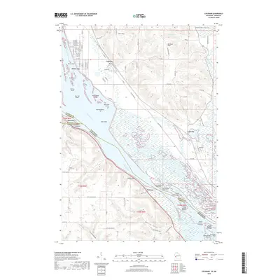
2018 Map of Cochrane
USGS Topo · Published 2018About this map
Buffalo City and Cochrane occupy the terrace between the high bluffs of Belvidere Ridge and the braided channels of the Mississippi River. This reach of the river is defined by a dense archipelago of named landforms, including Pelican Island, Water Snake Island, and Snipe Island, interspersed with complex waterways like Belvidere Slough and Haddock Slough. The Burlington railroad line tracks the river's edge, serving the small riverside communities of Whitman and Minneiska. Away from the main channel, the landscape rises sharply into dramatic bluff country, cut by deep ravines like Deering Valley and Preston Valley. Notable landmarks such as Chimney Rock and the Mount Vernon Cem provide specific points of reference for local historians, while the network of ridges including Huber Ridge and the Waumandee Valley illustrate the agricultural patterns established in the upland interiors of Buffalo County.
Find a feature on this map
87 named features on this map. Tap any name to fly to it.
Don’t see what you’re looking for? This feature index may not catch every label — zoom into the map to look around manually.
Map Details
Editions of this 2018 Cochrane Map
This is the sole edition of this map. No revisions or reprints were ever made.
Other maps of this area

1929 · Fountain City
USGS Topo · 1:62,500

1932 · Cochrane
USGS Topo · 1:62,500

1932 · Gilmanton
USGS Topo · 1:62,500

1932 · Alma
USGS Topo · 1:62,500

1934 · Winona
USGS Topo · 1:62,500

1934 · Cochrane
USGS Topo · 1:62,500

1937 · Winona
USGS Topo · 1:62,500

1937 · Cochrane
USGS Topo · 1:62,500

1950 · Alma
USGS Topo · 1:62,500

1953 · Eau Claire
USGS Topo · 1:250,000