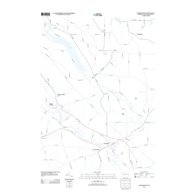
2013 Map of Cochranton
USGS Topo · Published 2013About this map
Cochranton serves as the primary hub of this Crawford County landscape, situated where the Little Sugar Creek meets French Creek. The region is defined by a dense network of rural crossroads and historical landing sites, such as Shaws Landing and Shaws Corners, reflecting the traditional settlement patterns of northwestern Pennsylvania. A notable hydrologic feature is Tamarack Lake, a long, narrow reservoir that dominates the northwest quadrant, while Conneaut Outlet provides drainage to the west. The map also identifies numerous family-named junctions, including McNamaras Corners, Kantz Corners, and Stockton Corners, which indicate longstanding agricultural land divisions. Distinctive natural landmarks like Pine Knoll and Round Knob rise above the drainage basins of Mud Run and Deckard Run, while the Ponce de Leon Spring near the northern border suggests localized natural interests within this intricate creek system.
Find a feature on this map
101 named features on this map. Tap any name to fly to it.
Don’t see what you’re looking for? This feature index may not catch every label — zoom into the map to look around manually.
Map Details
Editions of this 2013 Cochranton Map
This is the sole edition of this map. No revisions or reprints were ever made.
Other maps of this area

1909 · Franklin
USGS Topo · 1:62,500

1911 · Franklin
USGS Topo · 1:62,500

1911 · Stoneboro
USGS Topo · 1:62,500

1913 · Stoneboro
USGS Topo · 1:62,500

1923 · Meadville
USGS Topo · 1:62,500

1925 · Meadville
USGS Topo · 1:62,500

1927 · Townville
USGS Topo · 1:48,000

1932 · Townville
USGS Topo · 1:62,500

1943 · Meadville
USGS Topo · 1:62,500

1943 · Stoneboro
USGS Topo · 1:62,500