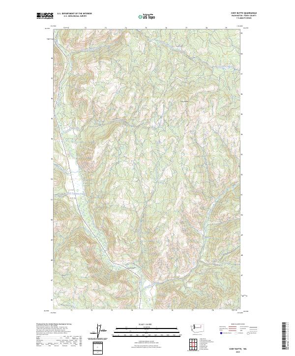
2023 Map of Cody Butte
USGS Topo · Published 2023About this map
Cody Butte stands as a prominent landmark in this upland territory of Ferry County, where the high-elevation terrain is defined by a dense network of watercourses. The Sanpoil River carves through the landscape, joined by numerous drainage systems including Twentyfive Mile Creek, Deadhorse Creek, and Cub Creek. This 2023 edition highlights a modern network of Bureau of Indian Affairs (BIA) routes and forest access roads, such as Cody Lookout Rd and S Nanamkin Creek Rd, which provide access to the remote ridges and valleys. A notable geographic feature, Devils Elbow, indicates the sharp bends and complex topography found along the creek basins. The map also records specialized routes like the Thirtymile Cr-Keno Trl, reflecting the area's ongoing use for recreation and land management within the Colville Indian Reservation region.
Find a feature on this map
25 named features on this map. Tap any name to fly to it.
Don’t see what you’re looking for? This feature index may not catch every label — zoom into the map to look around manually.
Map Details
Editions of this 2023 Cody Butte Map
This is the sole edition of this map. No revisions or reprints were ever made.
Other maps of this area

1950 · Nespelem
USGS Topo · 1:62,500

1952 · Keller
USGS Topo · 1:62,500

1953 · Seventeenmile Mtn.
USGS Topo · 1:62,500

1953 · Bald Knob
USGS Topo · 1:62,500

1954 · Okanogan
USGS Topo · 1:250,000

1958 · Okanogan
USGS Topo · 1:250,000

1984 · Nespelem
USGS Topo · 1:100,000

1986 · Central Peak
USGS Topo · 1:24,000
1989 · Nespelem NE
USGS Topo · 1:24,000
1989 · Seventeenmile Mountain
USGS Topo · 1:24,000