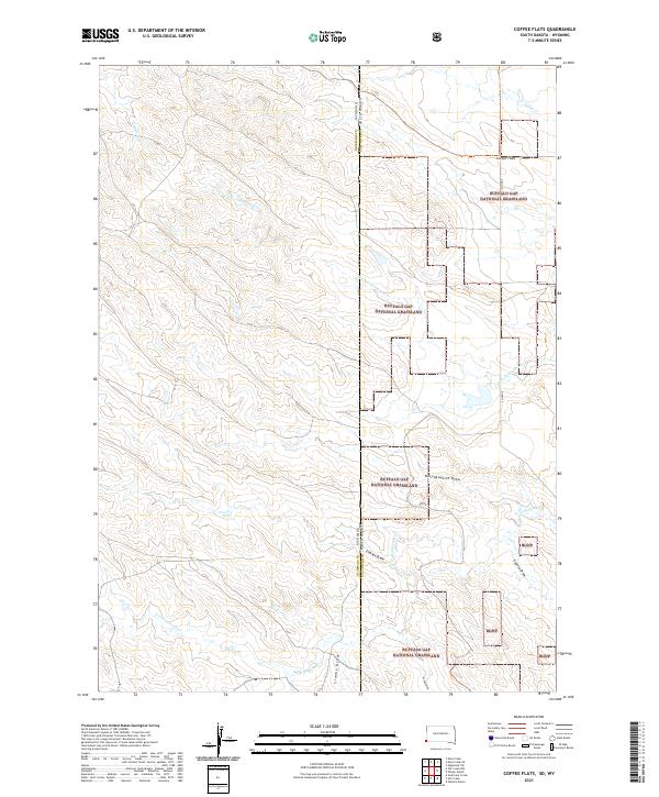
2021 Map of Coffee Flats
USGS Topo · Published 2021About this map
Buffalo Gap National Grassland dominates this section of the Great Plains, straddling the state line between Niobrara County, Wyoming, and Fall River County, South Dakota. The landscape is defined by a dense network of intermittent drainages and draws that carve through the high prairie, including Hollingsworth Draw, Eldridge Draw, and Coyote Draw. These features converge toward watercourses like Little Cottonwood Cr and Cottonwood Cr, illustrating the complex hydrology of this arid grazing land.
Find a feature on this map
22 named features on this map. Tap any name to fly to it.
Don’t see what you’re looking for? This feature index may not catch every label — zoom into the map to look around manually.
Map Details
Editions of this 2021 Coffee Flats Map
This is the sole edition of this map. No revisions or reprints were ever made.
Other maps of this area

1902 · Edgemont
USGS Topo · 1:125,000

1950 · Edgemont SW
USGS Topo · 1:24,000

1955 · Hot Springs
USGS Topo · 1:250,000

1955 · Newcastle
USGS Topo · 1:250,000

1958 · Newcastle
USGS Topo · 1:250,000

1978 · Mule Creek
USGS Topo · 1:24,000

1978 · Coffee Flats
USGS Topo · 1:24,000
1978 · Oat Creek NW
USGS Topo · 1:24,000
1978 · South Oat Creek
USGS Topo · 1:24,000
1978 · Oat Creek
USGS Topo · 1:24,000