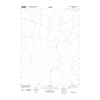
2010 Map of Coffeepot Spring
USGS Topo · Published 2010About this map
Vermillion Bluffs dominate the southern portion of this landscape, where the high desert terrain is defined by a network of seasonal drainages and essential water sources. This remote corner of Sweetwater County relies on points like Coffeepot Spring to sustain life in a territory marked by wide depressions and high flats. Significant natural landmarks such as Racetrack Flat and the evocative Beaver Slide Draw indicate a topography shaped by erosion and intermittent water flow. The map records several named drainages, including Shell Creek, Dry Creek, and the long reach of Powder Wash, which together illustrate the hydrologic character of the basin. A rudimentary road network consisting of routes like County Rd-4 and County Rd-88 provides the only access through these expansive draws and washes.
Find a feature on this map
15 named features on this map. Tap any name to fly to it.
Don’t see what you’re looking for? This feature index may not catch every label — zoom into the map to look around manually.
Map Details
Editions of this 2010 Coffeepot Spring Map
This is the sole edition of this map. No revisions or reprints were ever made.
Other maps of this area

1954 · Vernal
USGS Topo · 1:250,000

1954 · Rock Springs
USGS Topo · 1:250,000

1958 · Vernal
USGS Topo · 1:250,000

1958 · Rock Springs
USGS Topo · 1:250,000

1960 · Vernal
USGS Topo · 1:250,000

1962 · Rock Springs
USGS Topo · 1:250,000

1966 · G Spring
USGS Topo · 1:24,000

1966 · Hiawatha
USGS Topo · 1:24,000
1968 · Chicken Creek SE
USGS Topo · 1:24,000

1969 · Sheepherder Springs
USGS Topo · 1:24,000