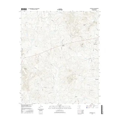
2016 Map of Coffeeville
USGS Topo · Published 2016About this map
Coffeeville sits in the northeast corner of this Upshur County landscape, a settlement defined by its rural crossroads and the nearby Coffeeville Cem. The terrain is shaped by numerous named peaks and ridges, including the Barnwell Mountains to the southwest and the central heights of New Mountain and Camp Mtn. These elevations are cut by an intricate drainage system where S Greasy Cr and Meddlin Cr flow through the timbered hills. The nomenclature of the local road system, featuring names like Daffodil Rd and Snapdragon Rd, suggests a specific era of residential development amidst the older rural structure. Small settlements such as Boxwood and Stamps anchor the eastern and southern edges of the map, while the name Coal Mine Hollow points to the area's geological and industrial history. This survey provides a look at the modern balance between East Texas piney woods and dispersed residential growth.
Find a feature on this map
71 named features on this map. Tap any name to fly to it.
Don’t see what you’re looking for? This feature index may not catch every label — zoom into the map to look around manually.
Map Details
Editions of this 2016 Coffeeville Map
This is the sole edition of this map. No revisions or reprints were ever made.
Other maps of this area

1956 · Tyler
USGS Topo · 1:250,000

1960 · Bettie
USGS Topo · 1:24,000

1960 · Gilmer
USGS Topo · 1:24,000

1960 · Coffeeville
USGS Topo · 1:24,000

1960 · Glenwood
USGS Topo · 1:24,000

1960 · La Fayette
USGS Topo · 1:24,000

1960 · Pittsburg
USGS Topo · 1:24,000

1962 · Ashland
USGS Topo · 1:24,000

1962 · Ore City
USGS Topo · 1:24,000

1962 · Lone Star
USGS Topo · 1:24,000