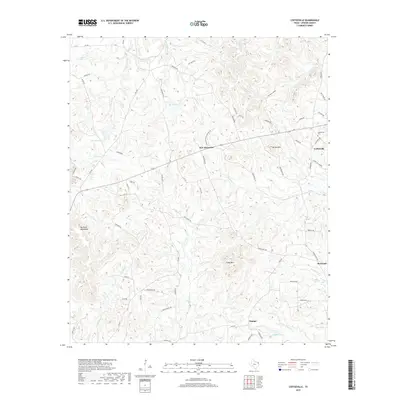
2019 Map of Coffeeville
USGS Topo · Published 2019About this map
Coffeeville and its surrounding rural communities are depicted in the piney woods of East Texas in this 2019 survey. The landscape is defined by the Barnwell Mountains and discrete peaks such as Brown Mtn and Camp Mtn, which overlook a network of creek drainages including Meddlin Cr and Gum Cr. Small-scale settlements like Boxwood, Stamps, and New Mountain are connected by a dense grid of local roads, many named after botanical features like Orchid Rd and Nasturtium Rd. Genealogists and local historians can locate the Coffeeville Cem north of the main townsite. The presence of Cool Mine Hollow suggests the historical industrial undercurrent of the region, while water bodies such as Beard Lake and Duffey Lake reflect the natural drainage patterns that have shaped land use in Upshur County for generations.
Find a feature on this map
72 named features on this map. Tap any name to fly to it.
Don’t see what you’re looking for? This feature index may not catch every label — zoom into the map to look around manually.
Map Details
Editions of this 2019 Coffeeville Map
This is the sole edition of this map. No revisions or reprints were ever made.
Other maps of this area

1956 · Tyler
USGS Topo · 1:250,000

1960 · Bettie
USGS Topo · 1:24,000

1960 · Gilmer
USGS Topo · 1:24,000

1960 · Coffeeville
USGS Topo · 1:24,000

1960 · Glenwood
USGS Topo · 1:24,000

1960 · La Fayette
USGS Topo · 1:24,000

1960 · Pittsburg
USGS Topo · 1:24,000

1962 · Ashland
USGS Topo · 1:24,000

1962 · Ore City
USGS Topo · 1:24,000

1962 · Lone Star
USGS Topo · 1:24,000