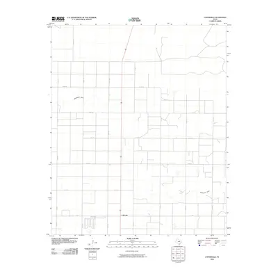
2010 Map of Cofferville
USGS Topo · Published 2010About this map
Cofferville and the surrounding agricultural plains of Lamb County are defined by a meticulous grid of rural infrastructure and the winding course of Blackwater Draw. The settlement sits at the intersection of FM 37 and Co Rd 207, serving as a focal point for the surrounding farmsteads. The landscape is dominated by large-scale farming tracts, interconnected by an extensive network of county roads including Co Rd 182 and Co Rd 227. This layout reflects the late 20th-century expansion of Texas High Plains agriculture, where the natural topography of the draw provides the only significant break in the geometric regularity of the section lines and irrigation-fed fields.
Find a feature on this map
18 named features on this map. Tap any name to fly to it.
Don’t see what you’re looking for? This feature index may not catch every label — zoom into the map to look around manually.
Map Details
Editions of this 2010 Cofferville Map
This is the sole edition of this map. No revisions or reprints were ever made.
Other maps of this area

1954 · Clovis
USGS Topo · 1:250,000

1954 · Brownfield
USGS Topo · 1:250,000

1957 · Anton
USGS Topo · 1:62,500

1958 · Brownfield
USGS Topo · 1:250,000

1958 · Clovis
USGS Topo · 1:250,000

1962 · Brownfield
USGS Topo · 1:250,000

1962 · Amherst
USGS Topo · 1:24,000

1962 · Cofferville
USGS Topo · 1:24,000

1962 · Springlake
USGS Topo · 1:24,000

1962 · Fieldton
USGS Topo · 1:24,000