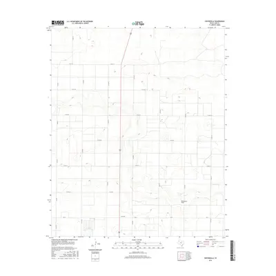
2016 Map of Cofferville
USGS Topo · Published 2016About this map
Cofferville sits at a crossroads in the High Plains of Lamb County, where the geometric precision of the Texas Panhandle's rural road network meets the natural contours of the South Plains. The landscape is defined by the ephemeral path of Blackwater Draw, which meanders across the southern portion of the sheet. This area is heavily organized around a grid of county roads, such as Co Rd 207 and Co Rd 195, facilitating the agricultural movement between larger state routes like FM 37 and FM 2479. The map reveals a high concentration of small, seasonal wetlands and depressions characteristic of the Llano Estacado, scattered throughout the sections and interrupted only by the long, low valley of the draw. This 2016 survey provides a clear view of the modern rural infrastructure and land management patterns in this part of West Texas.
Find a feature on this map
18 named features on this map. Tap any name to fly to it.
Don’t see what you’re looking for? This feature index may not catch every label — zoom into the map to look around manually.
Map Details
Editions of this 2016 Cofferville Map
This is the sole edition of this map. No revisions or reprints were ever made.
Other maps of this area

1954 · Clovis
USGS Topo · 1:250,000

1954 · Brownfield
USGS Topo · 1:250,000

1957 · Anton
USGS Topo · 1:62,500

1958 · Brownfield
USGS Topo · 1:250,000

1958 · Clovis
USGS Topo · 1:250,000

1962 · Brownfield
USGS Topo · 1:250,000

1962 · Amherst
USGS Topo · 1:24,000

1962 · Cofferville
USGS Topo · 1:24,000

1962 · Springlake
USGS Topo · 1:24,000

1962 · Fieldton
USGS Topo · 1:24,000