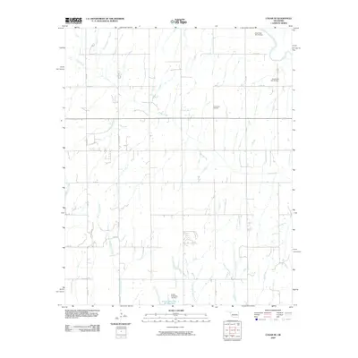
2009 Map of Cogar SE
USGS Topo · Published 2009About this map
Center View Cemetery stands as a central landmark in this rural Oklahoma landscape, situated within a grid of section-line roads such as Co RD 1150 and CS 2790. The terrain is defined by a complex drainage system that feeds toward the Canadian River in the northeast corner. Water management is a primary feature of the area, evidenced by multiple flood control structures including the Cow Creek Site 44 Dam and the Ionine Creek Site 101 Reservoir. The intricate network of waterways, ranging from Buggy Creek to the descriptive Stinking Creek, illustrates the hydraulic character of the region. The map captures the highly organized agricultural layout of the early 21st century, where farm access roads connect disparate homesteads to the primary county road system. This survey provides a clear look at the intersection of natural watercourses like West Ionine Creek and the man-made infrastructure required to sustain the local economy.
Find a feature on this map
28 named features on this map. Tap any name to fly to it.
Don’t see what you’re looking for? This feature index may not catch every label — zoom into the map to look around manually.
Map Details
Editions of this 2009 Cogar SE Map
This is the sole edition of this map. No revisions or reprints were ever made.
Other maps of this area

1893 · Buggy Creek
USGS Topo · 1:62,500

1893 · Minco
USGS Topo · 1:62,500

1904 · Chickasha
USGS Topo · 1:125,000

1945 · Anadarko
USGS Topo · 1:62,500

1954 · Oklahoma City
USGS Topo · 1:250,000

1955 · Clinton
USGS Topo · 1:250,000

1957 · Clinton
USGS Topo · 1:250,000

1957 · Oklahoma City
USGS Topo · 1:250,000

1963 · Oklahoma City
USGS Topo · 1:250,000
1966 · Pocasset
USGS Topo · 1:24,000