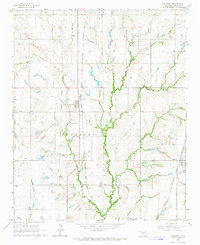
1966 Map of Pocasset
USGS Topo · Published 1967About this map
The Old Indian Territory Boundary Line bisects this mid-1960s landscape, serving as a silent reminder of the region's complex administrative history. Centered on the community of Pocasset, the map illustrates a rural Oklahoma economy anchored by agriculture and transport. The Chicago Rock Island and Pacific railroad runs north-south through the heart of the township, while the St Louis San Francisco line skirts the eastern edge near Amber. This era captures the area's established network of section-line roads and family-centered landmarks, including the Pocasset Cem and Amber Cem. The drainage patterns of Salt Creek, West Fork, and Otter Creek define the local topography, punctuated by industrial activity at the southern Gravel Pits. Local boundaries such as the Dutt On Line and Prairie highlight the specific surveying divisions that shaped Grady County.
Find a feature on this map
17 named features on this map. Tap any name to fly to it.
Don’t see what you’re looking for? This feature index may not catch every label — zoom into the map to look around manually.
Map Details
Editions of this 1966 Pocasset Map
2 editions found
Other maps of this area

1893 · Buggy Creek
USGS Topo · 1:62,500

1893 · Minco
USGS Topo · 1:62,500

1904 · Chickasha
USGS Topo · 1:125,000

1945 · Anadarko
USGS Topo · 1:62,500

1954 · Oklahoma City
USGS Topo · 1:250,000

1955 · Clinton
USGS Topo · 1:250,000

1957 · Clinton
USGS Topo · 1:250,000

1957 · Oklahoma City
USGS Topo · 1:250,000

1963 · Oklahoma City
USGS Topo · 1:250,000
1966 · Chickasha
USGS Topo · 1:24,000