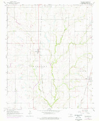
1966 Map of Pocasset
USGS Topo · Published 1976About this map
The Old Indian Territory Boundary Line runs vertically through the center of this landscape, marking a significant historical division in central Oklahoma. To the east, the settlement of Pocasset serves as a local hub along the Chicago Rock Island and Pacific railroad, while the town of Amber sits further southeast near the St Louis San Francisco tracks.
Find a feature on this map
17 named features on this map. Tap any name to fly to it.
Don’t see what you’re looking for? This feature index may not catch every label — zoom into the map to look around manually.
Map Details
Editions of this 1966 Pocasset Map
2 editions found
Other maps of this area

1893 · Buggy Creek
USGS Topo · 1:62,500

1893 · Minco
USGS Topo · 1:62,500

1904 · Chickasha
USGS Topo · 1:125,000

1945 · Anadarko
USGS Topo · 1:62,500

1954 · Oklahoma City
USGS Topo · 1:250,000

1955 · Clinton
USGS Topo · 1:250,000

1957 · Clinton
USGS Topo · 1:250,000

1957 · Oklahoma City
USGS Topo · 1:250,000

1963 · Oklahoma City
USGS Topo · 1:250,000
1966 · Chickasha
USGS Topo · 1:24,000