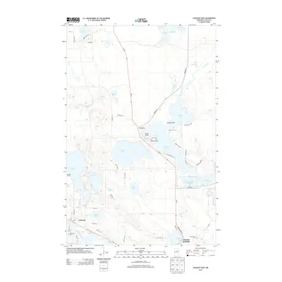
2013 Map of Cohasset East
USGS Topo · Published 2013About this map
Mississippi River waters flow through the southwestern corner of this Itasca County landscape, where the settlement of Cohasset serves as a gateway to a dense network of glacial lakes and wetlands. The industrial legacy of the region is evident in the Lind Greenway Tailings Basin and the Paper Mill Reservoir, reflecting the intersection of natural resources and local commerce. Moving north along MN-38, the terrain opens into several large bodies of water including Prairie Lake and Shoal Lake, which are punctuated by landmarks like Prairie Island and Mallard Point.
Find a feature on this map
64 named features on this map. Tap any name to fly to it.
Don’t see what you’re looking for? This feature index may not catch every label — zoom into the map to look around manually.
Map Details
Editions of this 2013 Cohasset East Map
This is the sole edition of this map. No revisions or reprints were ever made.
Other maps of this area

1920 · Trout Lake
USGS Topo · 1:62,500

1952 · Bovey
USGS Topo · 1:24,000

1953 · Cohasset East
USGS Topo · 1:24,000

1953 · Siseebakwet Lake
USGS Topo · 1:24,000

1953 · Cohasset West
USGS Topo · 1:24,000

1953 · Grand Rapids
USGS Topo · 1:24,000

1954 · Hibbing
USGS Topo · 1:250,000

1957 · Hibbing
USGS Topo · 1:250,000

1958 · Hibbing
USGS Topo · 1:250,000

1964 · Hibbing
USGS Topo · 1:250,000