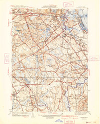
1941 Map of Cohasset
USGS Topo · Published 1941About this map
Cohasset Harbor and the jagged Atlantic coastline define this 1941 landscape, where established maritime settlements meet a dense network of inland brooks and swamps. The New York New Haven and Hartford railroad tracks wind through Nantasket Junc and Beechwood, connecting the coastal villages of Minot and North Scituate to the interior. Notable local landmarks like the Lawson Tower and the Old Oaken Bucket Homestead highlight the area's deep historical roots near Scituate Center.
Find a feature on this map
141 named features on this map. Tap any name to fly to it.
Don’t see what you’re looking for? This feature index may not catch every label — zoom into the map to look around manually.
Map Details
Editions of this 1941 Cohasset Map
3 editions found
Other maps of this area

1885 · Abington
USGS Topo · 1:62,500

1885 · Duxbury
USGS Topo · 1:62,500

1888 · Duxbury
USGS Topo · 1:62,500

1888 · Abington
USGS Topo · 1:62,500

1892 · Boston Bay
USGS Topo · 1:62,500

1893 · Abington
USGS Topo · 1:62,500

1893 · Duxbury
USGS Topo · 1:62,500

1903 · Boston Bay
USGS Topo · 1:62,500

1918 · Duxbury
USGS Topo · 1:62,500

1920 · Abington
USGS Topo · 1:62,500