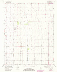
1956 Map of Coit Ranch
USGS Topo · Published 1984About this map
Vista del Llano Farm and Coit Ranch anchor this landscape of intensive agricultural development in Fresno County. Surveyed in the mid-1950s with updates into the early 1980s, the map reveals a meticulously organized grid of roads and irrigation infrastructure. The territory is defined by large-scale farming operations, including Murietta Farm, supported by industrial agriculture facilities like Grain Elevators and Grain Tanks. The layout of the land reflects the mid-century expansion of the Central Valley's water management and transport systems, evidenced by the numerous wells and the Mendota Substation. Transportation and logistics are facilitated by a dedicated Landing Strip and a network of arterial roads such as Derrick Avenue and California Avenue, which divide the terrain into precise sections for large-scale production and local commerce.
Find a feature on this map
33 named features on this map. Tap any name to fly to it.
Don’t see what you’re looking for? This feature index may not catch every label — zoom into the map to look around manually.
Map Details
Editions of this 1956 Coit Ranch Map
4 editions found
Other maps of this area

1913 · Panoche
USGS Topo · 1:125,000

1921 · Mendota
USGS Topo · 1:31,680

1922 · Tufts Ranch
USGS Topo · 1:31,680

1922 · Chaney Ranch
USGS Topo · 1:31,680

1923 · Levis
USGS Topo · 1:31,680

1923 · Wisdom Well
USGS Topo · 1:31,680

1923 · Englebrecht Ranch
USGS Topo · 1:31,680

1923 · Firebaugh
USGS Topo · 1:31,680

1923 · Monocline Ridge
USGS Topo · 1:31,680

1924 · Tranquillity
USGS Topo · 1:31,680