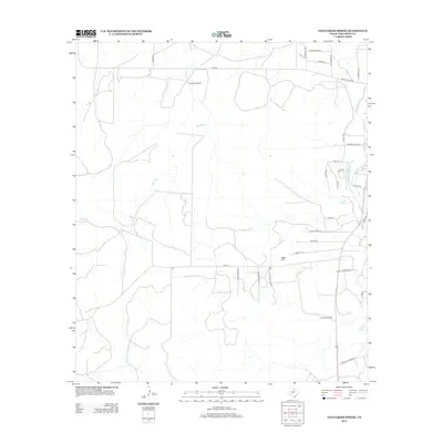
2012 Map of Cold Creek Spring
USGS Topo · Published 2012About this map
Cold Creek Spring and the nearby Mill Spring define the water resources of this Tom Green County landscape, situated where the Edwards Plateau begins to influence the drainage of the Concho River basin. The geography is characterized by the S Concho River and its intricate South Concho Irrigation Canal system, which reflects the historical dependence on managed water for agriculture in West Texas. Landmarks like Sulphur Windmill and Turkey Windmill indicate the continued importance of groundwater for ranching operations across the terrain surrounding Burks Cr. The road network, including Head of the River Rd and Ranch Road 2335, connects scattered residences and ranch sites, while Allen Hill provides a distinct topographical reference point in an area defined by winding creeks and intermittent draws.
Find a feature on this map
36 named features on this map. Tap any name to fly to it.
Don’t see what you’re looking for? This feature index may not catch every label — zoom into the map to look around manually.
Map Details
Editions of this 2012 Cold Creek Spring Map
This is the sole edition of this map. No revisions or reprints were ever made.
Other maps of this area

1892 · San Angelo
USGS Topo · 1:125,000

1895 · Sherwood
USGS Topo · 1:125,000

1924 · San Angelo 2-c
USGS Topo · 1:48,000

1924 · Sherwood 1-d
USGS Topo · 1:48,000

1928 · Wall
USGS Topo · 1:62,500

1928 · Tankersly
USGS Topo · 1:62,500

1954 · San Angelo
USGS Topo · 1:250,000

1957 · Knickerbocker
USGS Topo · 1:62,500

1957 · Wall
USGS Topo · 1:62,500

1958 · San Angelo
USGS Topo · 1:250,000