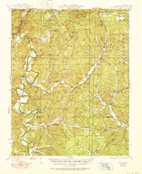
1930 Map of Coldwater
USGS Topo · Published 1951About this map
The St Francis River cuts through the heavy timber and rugged hills of the Saint Francois National Forest in this mid-century survey of Madison and Wayne counties. A way of life centered on the river and its many tributaries is evident in the numerous river crossings, including Wide Ford, Marsh Ford, and Shelton Ford, which provided vital links before the widespread construction of bridges. The map reveals a highly localized social landscape, where the community's rhythm was anchored by small schools and churches like King Sch, Ebenezer Ch, and Miller Chapel. At French Mills, the confluence of Marble Creek and the river suggests an early industrial focus, while the distribution of family cemeteries such as Revelle Cem offers critical data for genealogists tracing Ozark ancestry. Numerous peaks, from Black Mtn to Rock Pile Mtn, define the topography of this Missouri interior.
Find a feature on this map
59 named features on this map. Tap any name to fly to it.
Don’t see what you’re looking for? This feature index may not catch every label — zoom into the map to look around manually.
Map Details
Editions of this 1930 Coldwater Map
4 editions found

Other maps of this area

1910 · Higdon
USGS Topo · 1:62,500

1926 · Des Arc
USGS Topo · 1:62,500

1929 · Des Arc
USGS Topo · 1:62,500

1930 · Coldwater
USGS Topo · 1:62,500

1932 · Piedmont
USGS Topo · 1:62,500

1933 · Marquand
USGS Topo · 1:62,500

1934 · Greenville
USGS Topo · 1:62,500

1935 · Zalma
USGS Topo · 1:62,500

1935 · Piedmont
USGS Topo · 1:62,500

1937 · Ironton
USGS Topo · 1:48,000