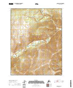
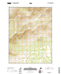
2018 Map of Coleen C-4 SW
USGS Topo · Published 2018About this map
Boulder Creek winds through the interior of the Yukon-Koyukuk Census Area, cutting across the southeastern and southwestern reaches of the landscape. The drainage system, which also includes the headwaters of Boulder Cr, shapes the topography within the Public Land Survey System divisions of t32n r21e, t32n r22e, t31n r21e, and t31n r22e. This area of interior Alaska is defined by a high-elevation drainage divide, where the relief rises above 1,800 feet near the eastern edge. The absence of roads or permanent structures in this 2018 survey emphasizes the isolation of the upper Boulder Creek basin, a territory primarily defined by its physical geography and the administrative boundaries of the National Geospatial Program.
Find a feature on this map
6 named features on this map. Tap any name to fly to it.
Don’t see what you’re looking for? This feature index may not catch every label — zoom into the map to look around manually.
Map Details
Editions of this 2018 Coleen C-4 SW Map
This is the sole edition of this map. No revisions or reprints were ever made.
Other maps of this area

1951 · Coleen
USGS Topo · 1:250,000

1956 · Coleen
USGS Topo · 1:250,000
1990 · Coleen C-4
USGS Topo · 1:63,360
1990 · Coleen B-5
USGS Topo · 1:63,360
1990 · Coleen B-4
USGS Topo · 1:63,360
1990 · Coleen C-5
USGS Topo · 1:63,360
2018 · Coleen C-5 SE
USGS Topo · 1:25,000
2018 · Coleen C-4 NW
USGS Topo · 1:25,000
2018 · Coleen C-5 NE
USGS Topo · 1:25,000
2018 · Coleen B-5 NE
USGS Topo · 1:25,000