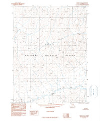
1990 Map of Coleen C-5
USGS Topo · Published 1990About this map
Arctic National Wildlife Refuge dominates this sub-arctic expanse, where high-altitude survey points like Owens 3005 and 2806t mark the interior peaks of the Brooks Range. Compiled from aerial photography taken in the late 1970s, the map reveals a landscape defined by seasonal water systems and glacial terrain. Water bodies like Boulder Creek in the south and Khytyam Creek in the northeast corner are the primary named drainage features, while several high-elevation lakes such as WL 1428t and WL 1285t are scattered throughout the northern and central sections. This 1990 provisional edition provides a rare technical view of the roadless wilderness before modern digital mapping, focusing on topographic relief and the precise township and range boundaries that define these remote public lands.
Find a feature on this map
71 named features on this map. Tap any name to fly to it.
Don’t see what you’re looking for? This feature index may not catch every label — zoom into the map to look around manually.
Map Details
Editions of this 1990 Coleen C-5 Map
This is the sole edition of this map. No revisions or reprints were ever made.
Other maps of this area

1951 · Coleen
USGS Topo · 1:250,000

1956 · Coleen
USGS Topo · 1:250,000
1972 · Coleen D-4
USGS Topo · 1:63,360
1972 · Coleen D-5
USGS Topo · 1:63,360

1972 · Coleen D-6
USGS Topo · 1:63,360
1983 · Coleen C-6
USGS Topo · 1:63,360
1990 · Coleen C-4
USGS Topo · 1:63,360
1990 · Coleen B-5
USGS Topo · 1:63,360
1990 · Coleen B-6
USGS Topo · 1:63,360
1990 · Coleen B-4
USGS Topo · 1:63,360