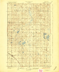
1929 Map of Coleharbor
USGS Topo · Published 1929About this map
Coleharbor anchors the southwestern corner of this McLean County landscape, positioned along the vital corridor of the Minneapolis St Paul and Sault Ste Marie railroad. The territory is defined by an intricate network of glacial prairie potholes and drainage systems, most notably the meandering Snake Creek which flows through the western townships. Surveyed in the mid-1920s, the map reveals a highly organized rural society structured around the township system, with labels such as Snow, Malcolm, and Linder marking these administrative blocks.
Find a feature on this map
19 named features on this map. Tap any name to fly to it.
Don’t see what you’re looking for? This feature index may not catch every label — zoom into the map to look around manually.
Map Details
Editions of this 1929 Coleharbor Map
3 editions found
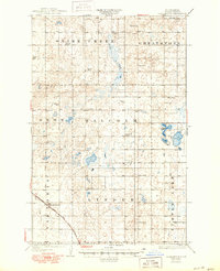
Other maps of this area

1922 · Garrison
USGS Topo · 1:62,500

1929 · Coleharbor
USGS Topo · 1:62,500

1929 · Benedict
USGS Topo · 1:62,500

1929 · Kongsberg
USGS Topo · 1:62,500

1947 · Turtle Lake
USGS Topo · 1:62,500

1948 · Stanton
USGS Topo · 1:62,500

1949 · Stanton
USGS Topo · 1:62,500

1949 · Turtle Creek
USGS Topo · 1:62,500

1949 · Washburn
USGS Topo · 1:62,500

1954 · McClusky
USGS Topo · 1:250,000