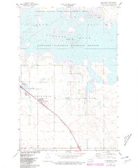
1972 Map of Coleharbor
USGS Topo · Published 1981About this map
Coleharbor stands at the intersection of rail and road commerce in this prairie landscape, where the Soo Line railroad and Highway 83 cut diagonally across the terrain of Victoria and Longfellow townships. This 1970s record highlights a region defined by massive water management projects and conservation efforts, dominated by the sprawling reaches of Lake Sakakawea and the Audubon National Wildlife Refuge. The map captures the transitional state of the shoreline, including the Wolf Creek State Game Management Arka and Audubon State Game Management Area. Local history is preserved in small details like the Coleharbor Cem and the settlement at Gateway, providing a look at the community structure before further modern development. The presence of a Gravel Pit and numerous marshy depressions like Lake Malcolm reflect the underlying glacial geology of the Missouri Plateau.
Find a feature on this map
18 named features on this map. Tap any name to fly to it.
Don’t see what you’re looking for? This feature index may not catch every label — zoom into the map to look around manually.
Map Details
Editions of this 1972 Coleharbor Map
2 editions found
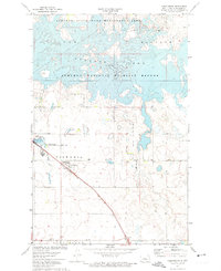
Other maps of this area

1922 · Garrison
USGS Topo · 1:62,500

1929 · Coleharbor
USGS Topo · 1:62,500

1948 · Stanton
USGS Topo · 1:62,500

1949 · Stanton
USGS Topo · 1:62,500

1949 · Washburn
USGS Topo · 1:62,500

1954 · McClusky
USGS Topo · 1:250,000

1958 · McClusky
USGS Topo · 1:250,000

1961 · Lake Nettie
USGS Topo · 1:24,000

1961 · Washburn NE
USGS Topo · 1:24,000

1961 · Underwood
USGS Topo · 1:24,000