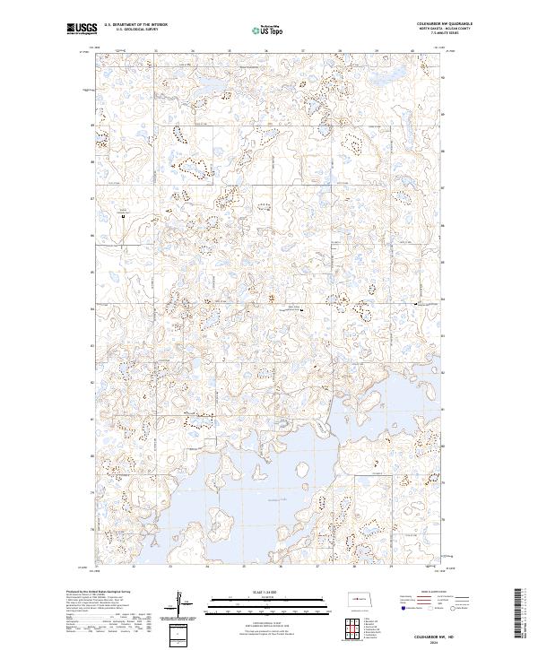
2024 Map of Coleharbor NW
USGS Topo · Published 2024About this map
Audubon Lake dominates the southern reaches of this McLean County landscape, where the prairie transitions into a complex network of wetlands and potholes. This modern survey illustrates a region shaped by conservation and rural tradition, anchored by the McLean County Waterfowl Production Area in the north. The cultural history of the plains is visible in the scattered country burial grounds that reflect early settlement patterns, including the Endres Catholic Cem, Saint Johns Congregational Cem, and First German Baptist Cem. The road network is a mix of section-line routes and modern access ways like Walleye Way and Scenic Way, which serve the recreational and residential interests centered around the lake. The presence of Old Hwy 83 running north-south provides a trace of former primary transportation corridors before contemporary highway realignments.
Find a feature on this map
40 named features on this map. Tap any name to fly to it.
Don’t see what you’re looking for? This feature index may not catch every label — zoom into the map to look around manually.
Map Details
Editions of this 2024 Coleharbor NW Map
This is the sole edition of this map. No revisions or reprints were ever made.
Other maps of this area

1922 · Garrison
USGS Topo · 1:62,500

1929 · Coleharbor
USGS Topo · 1:62,500

1929 · Benedict
USGS Topo · 1:62,500

1954 · McClusky
USGS Topo · 1:250,000

1958 · McClusky
USGS Topo · 1:250,000

1961 · Lake Nettie
USGS Topo · 1:24,000
1972 · Coleharbor
USGS Topo · 1:24,000
1972 · Riverdale North
USGS Topo · 1:24,000

1974 · Benedict SE
USGS Topo · 1:24,000
1974 · Coleharbor NE
USGS Topo · 1:24,000