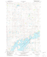
1981 Map of Coleharbor NW
USGS Topo · Published 1982About this map
Lake Audubon Elevation 1848 dominates the southern landscape of this McLean County survey, reflecting the significant water management and conservation efforts in central North Dakota during the early 1980s. The map illustrates the extensive Audubon State Wildlife Management Area and the National Waterfowl Production Area, highlighting the region's importance for migratory birds and local conservation. Away from the shoreline, the prairie is marked by small settlements like Townhall and Sidler, alongside vital local landmarks such as St Adolphs Cem and the Gemeinde-Giek Cem. This topography captures a transition where traditional agriculture and rural township sites meet large-scale environmental preservation, further evidenced by localized Gravel Pits and the S N A K E C R E E K drainage basin.
Find a feature on this map
17 named features on this map. Tap any name to fly to it.
Don’t see what you’re looking for? This feature index may not catch every label — zoom into the map to look around manually.
Map Details
Editions of this 1981 Coleharbor NW Map
This is the sole edition of this map. No revisions or reprints were ever made.
Other maps of this area

1922 · Garrison
USGS Topo · 1:62,500

1929 · Coleharbor
USGS Topo · 1:62,500

1929 · Benedict
USGS Topo · 1:62,500

1954 · McClusky
USGS Topo · 1:250,000

1958 · McClusky
USGS Topo · 1:250,000

1961 · Lake Nettie
USGS Topo · 1:24,000
1972 · Coleharbor
USGS Topo · 1:24,000
1972 · Riverdale North
USGS Topo · 1:24,000

1974 · Benedict SE
USGS Topo · 1:24,000
1974 · Coleharbor NE
USGS Topo · 1:24,000