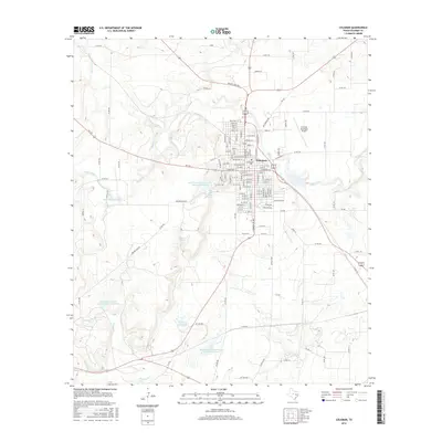
2016 Map of Coleman
USGS Topo · Published 2016About this map
Coleman serves as the central hub for this portion of West Texas, organized around a dense grid of streets including Highway St and Columbus St. The landscape surrounding the city is defined by an extensive network of water management features, including the Old City Lake and numerous reservoirs like Soil Conservation Service Site 38a Reservoir. These man-made structures are integrated into the natural drainage basins of Hords Creek and Bachelor Prong. To the east, the Coleman Municipal Airport marks the edge of the urban area before the terrain transitions into ranching and agricultural lands. Family-named landmarks such as Taylor Brothers Lake and recreational points like Country Club Lake highlight the intersection of private land use and community resources. The map captures a high level of detail in the transport network, tracing numerous county roads such as Co RD 422 and Co RD 402 that connect the outlying rural properties to the city center.
Find a feature on this map
134 named features on this map. Tap any name to fly to it.
Don’t see what you’re looking for? This feature index may not catch every label — zoom into the map to look around manually.
Map Details
Editions of this 2016 Coleman Map
This is the sole edition of this map. No revisions or reprints were ever made.
Other maps of this area

1887 · Coleman
USGS Topo · 1:125,000

1889 · Coleman
USGS Topo · 1:125,000

1892 · Ballinger
USGS Topo · 1:125,000

1932 · Voss
USGS Topo · 1:62,500

1954 · Brownwood
USGS Topo · 1:250,000

1960 · Lake Scarborough
USGS Topo · 1:24,000
1960 · Coleman NE
USGS Topo · 1:24,000

1962 · Santa Anna
USGS Topo · 1:24,000
1963 · Lake San Tana
USGS Topo · 1:24,000
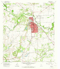
1963 · Coleman
USGS Topo · 1:24,000