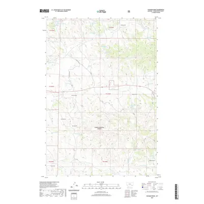
2020 Map of Coleman Draw
USGS Topo · Published 2020About this map
Custer National Forest encompasses much of this landscape in Powder River County, characterized by a complex network of draws and springs essential for high-plains water management. The terrain is marked by family-named and topographic features like Red Top Hill, Thomas Draw, and Stafford Draw, illustrating the deep-rooted ranching and land-use history of this Montana region. Water security in this arid environment is evidenced by numerous small-scale catchments including Daily Reservoir, Gaskill Reservoir, and Hanic Reservoir. These man-made features, alongside named natural sources such as Coal Bank Spring and Tucker Spring, define the settlement patterns and livestock routes through the coulees. The presence of Schoolhouse Draw suggests the locations of former rural gathering points, while the drainage of Daily Creek and Home Creek provides the primary hydrological structure for the surrounding rangeland.
Find a feature on this map
54 named features on this map. Tap any name to fly to it.
Don’t see what you’re looking for? This feature index may not catch every label — zoom into the map to look around manually.
Map Details
Editions of this 2020 Coleman Draw Map
This is the sole edition of this map. No revisions or reprints were ever made.
Other maps of this area

1954 · Hardin
USGS Topo · 1:250,000

1954 · Ekalaka
USGS Topo · 1:250,000

1956 · Ekalaka
USGS Topo · 1:250,000

1957 · Hardin
USGS Topo · 1:250,000

1958 · Ekalaka
USGS Topo · 1:250,000

1958 · Hardin
USGS Topo · 1:250,000

1965 · Ekalaka
USGS Topo · 1:250,000

1966 · Coleman Draw
USGS Topo · 1:24,000

1966 · Stacey
USGS Topo · 1:24,000

1966 · Home Creek Butte
USGS Topo · 1:24,000