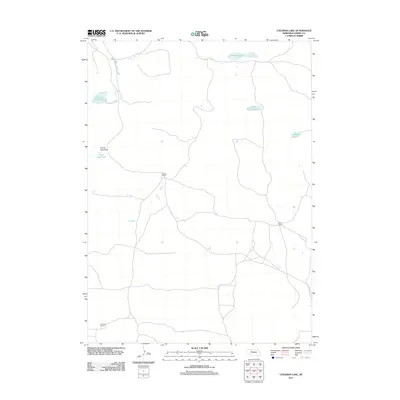
2011 Map of Coleman Lake
USGS Topo · Published 2011About this map
Newton Ranch and Starr Ranch anchor this landscape in Cherry County, Nebraska, representing the established cattle-ranching tradition of the Sandhills. The terrain is defined by a series of shallow basins and isolated water bodies, such as Flowing Well Lake and Carpenter Lake, which are essential for livestock in this semi-arid environment. The presence of Prairie Dog Flats illustrates the natural prairie ecology that coexists with the ranching operations. In the southern portion of the quadrangle, Prentice Ranch sits near a network of local roads that provide the only connectivity through this sparsely populated territory. The distribution of Coleman Lake and Little Coleman Lake further demonstrates the characteristic hydrologic pattern of the region, where internal drainage and localized wetlands serve as vital points of interest for land management and local history.
Find a feature on this map
8 named features on this map. Tap any name to fly to it.
Don’t see what you’re looking for? This feature index may not catch every label — zoom into the map to look around manually.
Map Details
Editions of this 2011 Coleman Lake Map
This is the sole edition of this map. No revisions or reprints were ever made.
Other maps of this area

1948 · Mullen
USGS Topo · 1:62,500

1949 · Big Falls
USGS Topo · 1:62,500

1950 · Hire
USGS Topo · 1:62,500

1950 · Wolf Lake
USGS Topo · 1:62,500

1951 · Mullen
USGS Topo · 1:62,500

1951 · Big Falls
USGS Topo · 1:62,500

1951 · Wolf Lake
USGS Topo · 1:62,500

1957 · Valentine
USGS Topo · 1:250,000

1959 · Valentine
USGS Topo · 1:250,000

1985 · Mullen
USGS Topo · 1:100,000