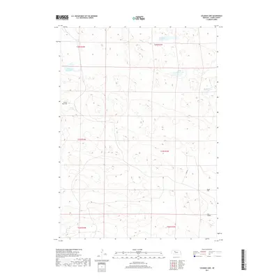
2017 Map of Coleman Lake
USGS Topo · Published 2017About this map
Coleman Lake and its smaller neighbor, Little Coleman Lake, dominate the northern reaches of this Cherry County landscape. This portion of the Nebraska Sandhills is defined by a complex hydrology of shallow basins and depressions, including the aptly named Flowing Well Lake and Carpenter Lake. The terrain transitions from these water bodies into broader, low-lying features like Prairie Dog Flats to the west and Poole Flat in the southeast. While largely characterized by its natural contours, the map shows minimal human infrastructure beyond the lone track of Cedar Dr and the southern stretch of Dry Valley. The absence of dense road networks or established settlements reflects the enduring, open ranching character of this region of the High Plains.
Find a feature on this map
14 named features on this map. Tap any name to fly to it.
Don’t see what you’re looking for? This feature index may not catch every label — zoom into the map to look around manually.
Map Details
Editions of this 2017 Coleman Lake Map
This is the sole edition of this map. No revisions or reprints were ever made.
Other maps of this area

1948 · Mullen
USGS Topo · 1:62,500

1949 · Big Falls
USGS Topo · 1:62,500

1950 · Hire
USGS Topo · 1:62,500

1950 · Wolf Lake
USGS Topo · 1:62,500

1951 · Mullen
USGS Topo · 1:62,500

1951 · Big Falls
USGS Topo · 1:62,500

1951 · Wolf Lake
USGS Topo · 1:62,500

1957 · Valentine
USGS Topo · 1:250,000

1959 · Valentine
USGS Topo · 1:250,000

1985 · Mullen
USGS Topo · 1:100,000