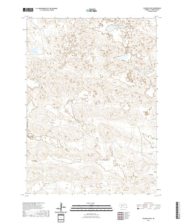
2021 Map of Coleman Lake
USGS Topo · Published 2021About this map
Coleman Lake and Little Coleman Lake sit within the distinct sandhills landscape of Cherry County, defining a region where water sources are critical landmarks. This 2021 survey illustrates a sparse settlement pattern dominated by topographic depressions and open basins such as Poole Flat and Dry Valley. The presence of Flowing Well Lake suggests the importance of artesian water sources in this environment, which is largely devoid of traditional town centers. Navigation through this terrain is primarily facilitated by primitive routes and named corridors like Cedar Dr, which provide access to the various lake basins including Carpenter Lake. To the west, the expansive Prairie Dog Flats highlights the broad, low-relief features characteristic of the Nebraska interior, providing a detailed view of the natural landforms before modern development or intensive infrastructure altered the local geography.
Find a feature on this map
14 named features on this map. Tap any name to fly to it.
Don’t see what you’re looking for? This feature index may not catch every label — zoom into the map to look around manually.
Map Details
Editions of this 2021 Coleman Lake Map
This is the sole edition of this map. No revisions or reprints were ever made.
Other maps of this area

1948 · Mullen
USGS Topo · 1:62,500

1949 · Big Falls
USGS Topo · 1:62,500

1950 · Hire
USGS Topo · 1:62,500

1950 · Wolf Lake
USGS Topo · 1:62,500

1951 · Mullen
USGS Topo · 1:62,500

1951 · Big Falls
USGS Topo · 1:62,500

1951 · Wolf Lake
USGS Topo · 1:62,500

1957 · Valentine
USGS Topo · 1:250,000

1959 · Valentine
USGS Topo · 1:250,000

1985 · Mullen
USGS Topo · 1:100,000