
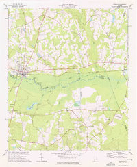
1973 Map of Colemans Lake
USGS Topo · Published 1976About this map
The Ogeechee River defines the eastern boundary of this landscape where the borders of Emanuel, Burke, and Jefferson counties meet. In the early 1970s, the area retained a strong rural character anchored by small communities like Midville, Summertown, and Cross and Green. The river's edge is marked by notable landmarks such as Franklins Bluff and Seven Cypresses, while the interior is dotted with numerous rural congregations and resting places, including Lambs Chapel, Piney Grove Ch, and Colemans Cem. Transportation history is evident through the path of the Central of Georgia railroad and sections of Old Railroad Grade, which sit alongside historic transit routes like Savannah Road. The hydrological network is further defined by Clear Spring Creek and Daniels Mill Creek, feeding into larger bodies like McGars Pond and the namesake Colemans Lake.
Find a feature on this map
44 named features on this map. Tap any name to fly to it.
Don’t see what you’re looking for? This feature index may not catch every label — zoom into the map to look around manually.
Map Details
Editions of this 1973 Colemans Lake Map
This is the sole edition of this map. No revisions or reprints were ever made.
Other maps of this area

1957 · Macon
USGS Topo · 1:250,000

1958 · Macon
USGS Topo · 1:250,000

1964 · Macon
USGS Topo · 1:250,000

1971 · Dellwood
USGS Topo · 1:24,000
1971 · Canoochee
USGS Topo · 1:24,000

1971 · Summertown
USGS Topo · 1:24,000
1973 · Louisville South
USGS Topo · 1:24,000
1973 · Old Town
USGS Topo · 1:24,000
1973 · Wadley
USGS Topo · 1:24,000
1974 · Midville
USGS Topo · 1:24,000