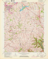
1965 Map of Coletown
USGS Topo · Published 1979About this map
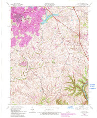
The rolling Bluegrass country southeast of Lexington is captured here during a period of suburban expansion into traditional farmland. Significant residential developments such as Lansdowne, Gainesway, and Southeastern Hills are shown encroaching upon the rural landscape, while established community anchors like Walnut Hill Church and the Shelby School maintain their positions along the narrow pikes. The terrain is defined by the winding course of East Hickman Creek and Lexington Reservoir No 4, leading down toward the steep bluffs of the Kentucky River at the map's southern edge. This 1965 survey, updated with 1971 purple revisions, reveals the early footprint of the New Circle Road and the growth of neighborhoods around the Tates Creek Country Club. Notable for local historians are the scattered family landmarks and small rural settlements like Coletown and East Hickman that existed before modern infill altered the character of the Fayette County countryside.
Find a feature on this map
52 named features on this map. Tap any name to fly to it.
Don’t see what you’re looking for? This feature index may not catch every label — zoom into the map to look around manually.
Map Details
Editions of this 1965 Coletown Map
5 editions found
Other maps of this area

1892 · Richmond
USGS Topo · 1:125,000

1897 · Richmond
USGS Topo · 1:125,000

1905 · Harrodsburg
USGS Topo · 1:125,000

1906 · Georgetown
USGS Topo · 1:62,500

1908 · Georgetown
USGS Topo · 1:62,500

1927 · Lexington
USGS Topo · 1:48,000

1929 · Lexington
USGS Topo · 1:62,500

1950 · Lexington East
USGS Topo · 1:24,000

1950 · Lexington West
USGS Topo · 1:24,000

1952 · Valley View
USGS Topo · 1:24,000
Featured Places
- Lexington, KY
- Southeastern Hills, Lexington
- Coletown, Lexington
- Jonestown, Lexington
- Gainesway, Lexington