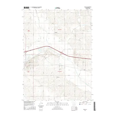
2015 Map of Colfax
USGS Topo · Published 2015About this map
The South Skunk River valley dominates this portion of Jasper County, shaping the settlement patterns around Colfax and Metz. The river's winding course creates a broad floodplain, while the surrounding upland terrain is dissected by numerous tributaries including Prairie Cr, Severs Cr, and Fullington Cr. The map captures a primarily agricultural landscape organized by a rigorous township and range grid, where family history is deeply etched into the land.
Find a feature on this map
70 named features on this map. Tap any name to fly to it.
Don’t see what you’re looking for? This feature index may not catch every label — zoom into the map to look around manually.
Map Details
Editions of this 2015 Colfax Map
This is the sole edition of this map. No revisions or reprints were ever made.
Other maps of this area

1930 · Mitchellville
USGS Topo · 1:62,500

1954 · Des Moines
USGS Topo · 1:250,000

1956 · Des Moines
USGS Topo · 1:250,000

1957 · Des Moines
USGS Topo · 1:250,000

1965 · Prairie City
USGS Topo · 1:24,000

1965 · Newton
USGS Topo · 1:24,000

1965 · Monroe
USGS Topo · 1:24,000

1965 · Colfax
USGS Topo · 1:24,000

1969 · Des Moines
USGS Topo · 1:250,000
1972 · Runnells
USGS Topo · 1:24,000