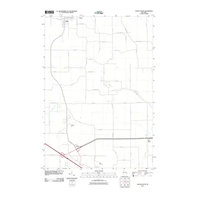
2010 Map of Colfax South
USGS Topo · Published 2010About this map
Colfax sits at the northern edge of this landscape, where the Colfax 2WP1143 Dam manages the local hydrology near Evergreen Cemetery. Moving south, the terrain is defined by a network of drainage systems including Sinking Creek, Muddy Creek, and the prominent Big Elk Creek, which carves a path toward the village of Elk Mound in the south. These watercourses historically dictated the placement of rural homesteads and the grid of county highways that crisscross the undulating land.
Find a feature on this map
48 named features on this map. Tap any name to fly to it.
Don’t see what you’re looking for? This feature index may not catch every label — zoom into the map to look around manually.
Map Details
Editions of this 2010 Colfax South Map
This is the sole edition of this map. No revisions or reprints were ever made.
Other maps of this area

1934 · Elk Mound
USGS Topo · 1:62,500

1936 · Elk Mound
USGS Topo · 1:62,500

1940 · Menomonie
USGS Topo · 1:62,500

1942 · Menomonie
USGS Topo · 1:62,500

1949 · New Auburn
USGS Topo · 1:62,500

1949 · Ridgeland
USGS Topo · 1:62,500

1951 · Ridgeland
USGS Topo · 1:62,500

1951 · New Auburn
USGS Topo · 1:62,500

1953 · Eau Claire
USGS Topo · 1:250,000

1953 · Rice Lake
USGS Topo · 1:250,000