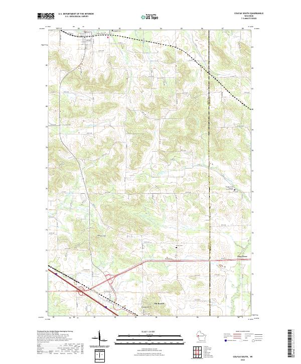
2022 Map of Colfax South
USGS Topo · Published 2022About this map
Elk Mound rises prominently in the south of this Dunn County landscape, overlooking a network of agricultural roads and glacial terrain. The village of Colfax anchors the northern boundary, where E Railroad Ave and River St define the early town grid near Evergreen Cem. This 2022 survey captures a rural Wisconsin corridor transitioning between the more densely settled outskirts of local hubs and the open farm country of T29N R11W.
Find a feature on this map
53 named features on this map. Tap any name to fly to it.
Don’t see what you’re looking for? This feature index may not catch every label — zoom into the map to look around manually.
Map Details
Editions of this 2022 Colfax South Map
This is the sole edition of this map. No revisions or reprints were ever made.
Other maps of this area

1934 · Elk Mound
USGS Topo · 1:62,500

1936 · Elk Mound
USGS Topo · 1:62,500

1940 · Menomonie
USGS Topo · 1:62,500

1942 · Menomonie
USGS Topo · 1:62,500

1949 · New Auburn
USGS Topo · 1:62,500

1949 · Ridgeland
USGS Topo · 1:62,500

1951 · Ridgeland
USGS Topo · 1:62,500

1951 · New Auburn
USGS Topo · 1:62,500

1953 · Eau Claire
USGS Topo · 1:250,000

1953 · Rice Lake
USGS Topo · 1:250,000