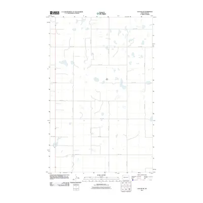
2011 Map of Colgan SE
USGS Topo · Published 2011About this map
Twin Butte rises as a prominent landmark above the surrounding prairie, anchoring this rural landscape in the northwest corner of the state. The terrain is characterized by a high concentration of small, scattered wetlands and glacial potholes typical of the region, which dictated the grid-like placement of the early 21st-century road network. Primary transit is facilitated by North Dakota Highway 85, which runs north-south through the western portion of the quadrangle, while County Rd-14 provides an east-west artery through the southern section. The area's agricultural identity is clearly defined by the precise section-line roads, such as 132nd Ave NW and 97th St Nw, which carve the landscape into a patchwork of productive fields and natural depressions.
Find a feature on this map
17 named features on this map. Tap any name to fly to it.
Don’t see what you’re looking for? This feature index may not catch every label — zoom into the map to look around manually.
Map Details
Editions of this 2011 Colgan SE Map
This is the sole edition of this map. No revisions or reprints were ever made.
Other maps of this area

1948 · Smoky Butte
USGS Topo · 1:24,000

1948 · Crosby SW
USGS Topo · 1:24,000

1948 · Ambrose
USGS Topo · 1:24,000

1948 · Stady
USGS Topo · 1:24,000

1948 · Bright Water Lake
USGS Topo · 1:24,000

1950 · Crosby
USGS Topo · 1:62,500

1953 · Williston
USGS Topo · 1:250,000

1957 · Williston
USGS Topo · 1:250,000

1983 · Colgan West
USGS Topo · 1:24,000

1983 · Alexandria
USGS Topo · 1:24,000