1918 Map of College Corner
USGS Topo · Published 1922About this map
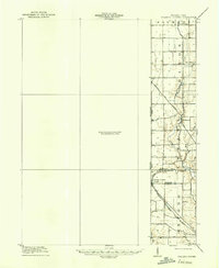
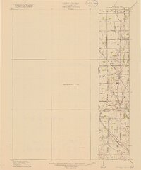
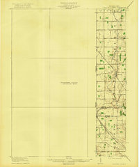
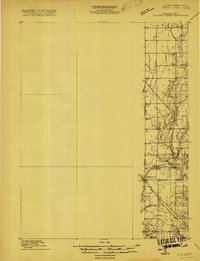
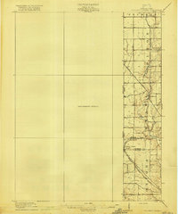
College Corner straddles the Indiana Ohio Boundary Line in this early twentieth-century survey, which reveals a landscape of rural hamlets and emerging transportation corridors. While much of the western quadrangle remains a Preliminary Edition Unsurveyed Area, the eastern portion detail is dense with localized features, from the clustered homes of West Florence to the remote School No 3. The Cincinnati Indianapolis and Western railroad cuts diagonally across the lower section, serving as a vital link for the border community near Talawanda Springs. This map captures the region's hydrography in detail, tracing the path of Talawanda Creek and the small tributaries like Harkers Run and Bull Run that define the drainage of the Israel and Dixon townships before the widespread modernization of the local road network.
Find a feature on this map
22 named features on this map. Tap any name to fly to it.
Don’t see what you’re looking for? This feature index may not catch every label — zoom into the map to look around manually.
Map Details
Editions of this 1918 College Corner Map
4 editions found
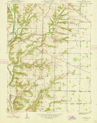
Other maps of this area
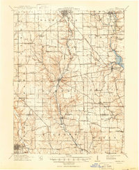
1911 · Oxford
USGS Topo · 1:62,500

1915 · New Paris
USGS Topo · 1:48,000
1915 · College Corner
USGS Topo · 1:48,000

1915 · Harrison
USGS Topo · 1:48,000

1915 · Hamilton
USGS Topo · 1:62,500

1917 · Hamilton
USGS Topo · 1:62,500
1918 · College Corner
USGS Topo · 1:62,500

1918 · New Paris
USGS Topo · 1:62,500
1948 · Fairfield
USGS Topo · 1:24,000

1953 · Cincinnati
USGS Topo · 1:250,000