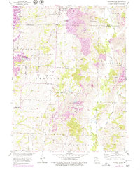
1953 Map of College Mound
USGS Topo · Published 1979About this map
College Mound stands as the primary settlement in this corner of Missouri, situated just north of the border between Macon and Randolph counties. This landscape is a patchwork of agricultural land and heavy industrial activity, most notably marked by the extensive Strip Mine operations and associated Tailings Pond that dominate the central and eastern sections. To the west, the Thomas Hill Reservoir has reshaped the valley of Brush Creek, providing a significant water feature that contrasts with the traditional rural grid of the mid-20th century. Local history and genealogy are well-represented by long-standing community landmarks such as Union Chapel, Eldad Ch, and Darksville, along with family-named burial sites like Barnhart Cem and Hickory Grove Cem. The presence of Holiday Lake and the Narrows along the Little Chariton River further defines the area's transition from coal extraction to managed water resources.
Find a feature on this map
30 named features on this map. Tap any name to fly to it.
Don’t see what you’re looking for? This feature index may not catch every label — zoom into the map to look around manually.
Map Details
Editions of this 1953 College Mound Map
2 editions found
Other maps of this area

1890 · Moberly
USGS Topo · 1:125,000

1890 · Glasgow
USGS Topo · 1:125,000

1908 · Macon
USGS Topo · 1:62,500

1910 · Macon
USGS Topo · 1:62,500

1953 · Moberly
USGS Topo · 1:250,000

1953 · Huntsville
USGS Topo · 1:24,000

1953 · Bevier South
USGS Topo · 1:24,000

1953 · College Mound
USGS Topo · 1:24,000

1953 · Clifton Hill
USGS Topo · 1:24,000
1953 · Moberly
USGS Topo · 1:24,000