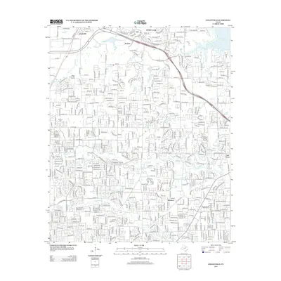
2012 Map of Colleyville
USGS Topo · Published 2012About this map
Roanoke and Westlake anchor the northern reaches of this suburban landscape, where the expansion of the Tarrant County and Denton County borderlands is clearly visible. The area is defined by its complex network of residential developments and historical markers, such as Medlin Cem and Bourland Cem, which sit alongside modern infrastructure. The Union Pacific rail corridor cuts through the western section, a reminder of the transport lines that once fueled smaller settlements like Bransford and Old Union.
Find a feature on this map
108 named features on this map. Tap any name to fly to it.
Don’t see what you’re looking for? This feature index may not catch every label — zoom into the map to look around manually.
Map Details
Editions of this 2012 Colleyville Map
This is the sole edition of this map. No revisions or reprints were ever made.
Other maps of this area

1894 · Fort Worth
USGS Topo · 1:125,000

1931 · Grapevine
USGS Topo · 1:62,500

1954 · Dallas
USGS Topo · 1:250,000

1954 · Sherman
USGS Topo · 1:250,000

1955 · Haltom City
USGS Topo · 1:24,000

1955 · Keller
USGS Topo · 1:24,000

1955 · Haltom City
USGS Topo · 1:62,500

1958 · Dallas
USGS Topo · 1:250,000

1958 · Sherman
USGS Topo · 1:250,000

1959 · Euless
USGS Topo · 1:24,000