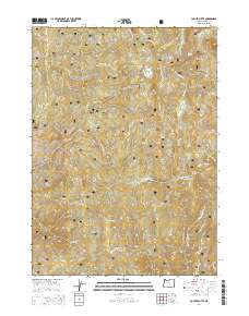
2014 Map of Collier Butte
USGS Topo · Published 2014About this map
Siskiyou National Forest dominates this 2014 survey of southwestern Oregon, where the complex drainage systems of the Pistol River and the Chetco River carve through high-elevation peaks. The topography is defined by prominent summits including Collier Butte and Snow Camp Mtn, while the presence of locations like Stack Yards and Three Trees suggests the area's history of backcountry resource management and seasonal habitation. This landscape is a network of ridges and meadows, such as Fairview Meadow and Snow Camp Meadow, connected by a web of Forest Service development roads.
Find a feature on this map
42 named features on this map. Tap any name to fly to it.
Don’t see what you’re looking for? This feature index may not catch every label — zoom into the map to look around manually.
Map Details
Editions of this 2014 Collier Butte Map
This is the sole edition of this map. No revisions or reprints were ever made.
Other maps of this area

1954 · Coos Bay
USGS Topo · 1:250,000

1954 · Cape Ferrelo
USGS Topo · 1:62,500

1954 · Gold Beach
USGS Topo · 1:62,500

1954 · Collier Butte
USGS Topo · 1:62,500

1954 · Mt. Emily
USGS Topo · 1:62,500

1958 · Coos Bay
USGS Topo · 1:250,000

1962 · Coos Bay
USGS Topo · 1:250,000
1986 · Carpenterville
USGS Topo · 1:24,000
1986 · Sundown Mtn
USGS Topo · 1:24,000
1986 · Signal Buttes
USGS Topo · 1:24,000