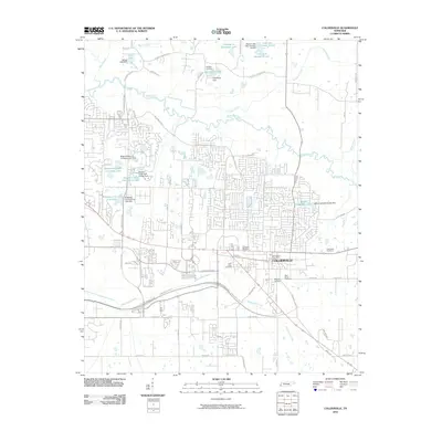
2010 Map of Collierville
USGS Topo · Published 2010About this map
Collierville stands as the primary hub in this suburban landscape, characterized by a transition from its traditional core to modern residential developments. The area is defined by a series of cemeteries that provide significant genealogical value, including Magnolia Cemetery, Saint James Cemetery, and Bethany Cemetery. The geography is shaped by the meandering Wolf River to the north and Nonconnah Creek to the south, with numerous man-made lakes such as Glynnwood Lake and Houston Levee Golf Course Lake punctuating the terrain. Major transportation corridors like the Nonconnah Pkwy and Bill Morris Pkwy facilitate regional connectivity. This survey documents the area's development pattern, where large country club properties like Ridgeway Country Club Lake sit alongside older landmarks like the Collierville Post Office.
Find a feature on this map
56 named features on this map. Tap any name to fly to it.
Don’t see what you’re looking for? This feature index may not catch every label — zoom into the map to look around manually.
Map Details
Editions of this 2010 Collierville Map
This is the sole edition of this map. No revisions or reprints were ever made.
Other maps of this area

1943 · Collierville
USGS Topo · 1:62,500

1944 · Hernando
USGS Topo · 1:62,500

1948 · Byhalia
USGS Topo · 1:62,500

1953 · Collierville
USGS Topo · 1:50,000

1956 · Blytheville
USGS Topo · 1:250,000

1956 · Tupelo
USGS Topo · 1:250,000

1958 · Tupelo
USGS Topo · 1:250,000

1959 · Blytheville
USGS Topo · 1:250,000

1960 · Bartlett
USGS Topo · 1:62,500

1961 · Bartlett
USGS Topo · 1:62,500